An article tells you one thing at a time. It never tells you what was around it, or what else was going on that year. Erask does both: pick a year and watch the whole world in it, or open a place and follow it to everything it touches — on a real 3D globe, out of Wikipedia, with nothing to sign up for.
You read about Krakatoa. The article mentions the Sunda Strait, the island of Panaitan the wave emptied, and Rodrigues — nearly five thousand kilometres away, in the section about how far the sound carried. They stay words in a paragraph. Put them on a globe and the distance becomes the story.
See how →You read about Waterloo, June 1815. In the same year the Congress of Vienna was redrawing Europe, and Mount Tambora had just erupted — the eruption that took the summer away. Nothing connects them except the year, and that turns out to be enough.
See how →Wikipedia knows where everything is, and it knows when everything happened. It just never shows you both at once.
Two of them start from time, two from place. All four end on the same globe.
A story is a chosen path through Wikipedia. Press play and dozens of places light up in the order it happened — a legion moving north, a merchant crossing Asia, a century of detonations — each one a tap away from the article that tells it. Chosen by hand, and every date and place checked before it ships.
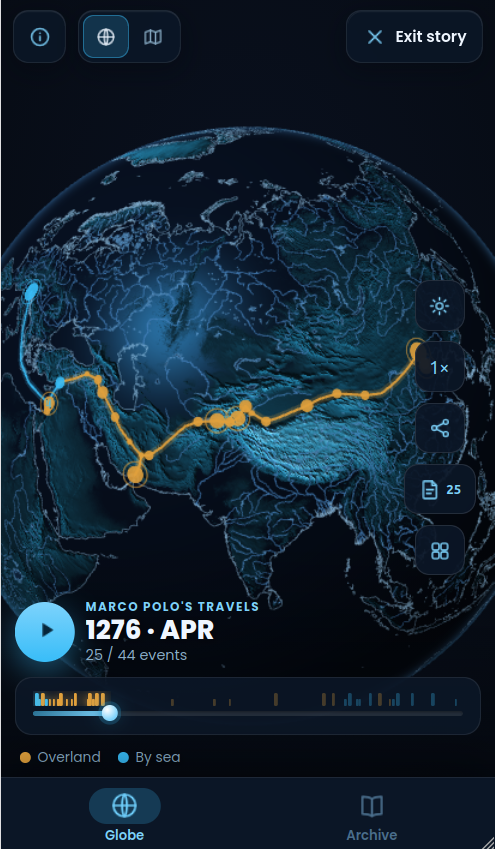
Scrub through the years, pause on a turning point, or run it at 1× to 8×. The date on screen is the date on the globe.
Journeys trace their path leg by leg, a moving point at the head of the line — twenty-four years of Marco Polo in under a minute.
Dozens of moments picked out of thousands, and every date and place verified against a table decided in advance — by a generator that refuses to publish when the check fails.
Battles, sieges, landfalls and tests appear as markers sized by scale. Tap one and Wikipedia opens on that exact moment in history.
How one species took the whole planet, 300,000 BC – AD 1300
1271 – 1299Venice to Xanadu and back, 1271–1295
1860 – 1865One country, torn in two and taken back battle by battle, 1860–1865
See all 22 stories → · 1 more in the making
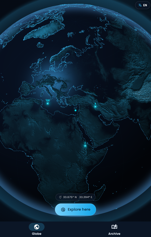
Not a flat map. A hand-crafted 3D globe with GPU-shaded mountain relief from NASA elevation data, precise vector coastlines, thousands of islands and cities that fade in as you fly closer. Drop a base to see what is around you — then follow any article to everything it mentions that sits somewhere on the map, one hop at a time.
Real elevation, shaded in real time on the GPU. The Alps, the Andes and the Himalaya cast their ridges across the sphere.
One tap on “Explore here” scans the area through Wikidata and reveals every notable place around your point — instantly.
Castles, cathedrals, volcanoes, glaciers, beaches, historical battles, sieges and expeditions. If it mattered, it’s on the globe.
Every place opens a gallery from Wikimedia Commons and the full article on Wikipedia, with the photographs and the text that go with it.
Hand-built timelines that play out on the globe, each one researched against its sources — and every event links to the article behind it.
Erask is a Progressive Web App — no app store, no download. It runs right in your browser; installing simply adds an icon and lets it open full-screen and work offline.
Every article, photo and date in Erask comes from Wikipedia, Wikidata and Wikimedia Commons — the free knowledge projects built by millions of volunteers. Read the full credits →
No sign-up, no login. Open the app and explore.
No ads, no analytics, no third-party trackers.
Bases, favorites and settings live only on your phone. Privacy policy →
Free, lightweight, and endlessly curious — just like you. No store, no sign-up.
Open Erask